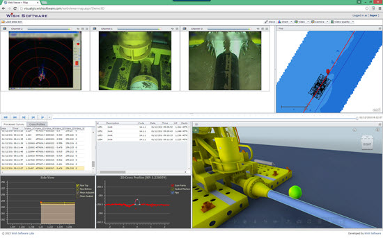
VisualGIS Server
VisualGIS Server is software that makes digital video and accompanying survey data available across an enterprise and the web.
Users can access their data on zero-client (no install) HTML5 compatible browser based viewers on devices such as Desktops, tablets or iPads.
Now includes ability to show 3D Model of Pipe, Structures and Seabed - all still in a no install browser
Share data by simply sending a web link and login details.
Video data is synchronised geographically with web maps provided by either ArcGIS Server or ArcGIS Online.
VisualGIS Server can be installed On-Premise or to the Cloud.
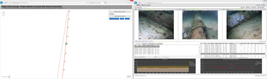
 Watch VisualGIS Server in action
Viewer Options
- Single Page Web Browser
- Dual Page Web Browser
- Desktop Hybrid
Please contact Wish Software for login to Demo Dataset.