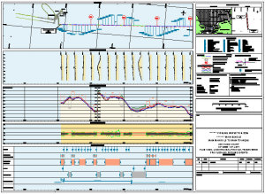
AutoChart
AutoChart is an AutoCAD extension that automates the production of North-Up
and alignment sheets.
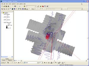
HydroGIS
HydroGIS is an ArcGIS extension that imports survey data into the GIS
environment.
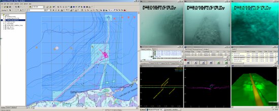
VisualGIS
VisualGIS is an ArcGIS extension that integrates the GIS environment with
the
VisualWorks Digital Video System.
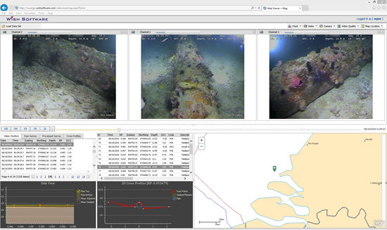
VisualGIS Server
VisualGIS Server is software that makes digital video and accompanying survey data available across an enterprise and the web.
Latest News
Product Updates
New Product
AutoChart for BricsCAD
released for BricsCAD 25
AutoChart for AutoCAD update released for Autodesk 2026 Suite
AutoChart and HydroGIS update released for Esri ArcGIS Pro 3.5
VisualGIS Server
Digital Video in the Browser - Now with 3D View!
Shell VisualGIS Server
Shell Norway has implemented VisualGIS Server in Azure Cloud allowing internal and external users access to Digital Video over the internet
more news...
Wish Software Blogs
Product Support Blog
Partners