HydroGIS
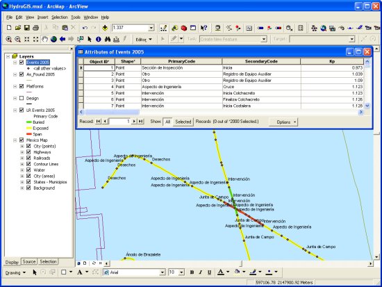
HydroGIS is an ArcGIS extension that imports survey data into the GIS
environment.
HydroGIS enables the creation of complex Geodatabases or shape files via
a simple software interface for a wide range of survey data formats.
Specifically designed for hydrographic survey data types; HydroGIS
eliminates the confusion and complexity of creating GIS final deliverables.
Data Types
- Survey Track
- Survey Objects (eg Targets, Cores etc)
- Soundings
- Pipeline Inspection Events
- Pipeline Inspection As-Found Position
- Pipeline Inspection Linear Events
- Field Data
Latest News
Product Updates
New Product
AutoChart for BricsCAD
released for BricsCAD 25
AutoChart for AutoCAD update released for Autodesk 2026 Suite
AutoChart and HydroGIS update released for Esri ArcGIS Pro 3.5
VisualGIS Server
Digital Video in the Browser - Now with 3D View!
Shell VisualGIS Server
Shell Norway has implemented VisualGIS Server in Azure Cloud allowing internal and external users access to Digital Video over the internet
more news...
Wish Software Blogs
Product Support Blog
Partners