|
|

|
FR136 - Create Cross Profiles |

|

|

|

|

|
||
|
FR136 - Create Cross Profiles |
|
|
|
|

|

|
FR136 - Create Cross Profiles
|
|
|
FR136 - Create Cross Profiles |
|
|
|
|
|
||
|
FR136 - Create Cross Profiles |
|
|
|
|
|
|
The Create Cross Profile command now has an option to specify which seabed marker to use as the lateral reference for the Cross Profiles. Previously, the cross profiles would always have been centered on the Top of Pipe or the point point where the specified route crosses the cross profile. Now the user can choose to center certain cross profile formats on a specified seabed marker such as Bottom of Trench or Top of Cover etc. (The choice of available markers will depend on the Cross Profile File Type that is selected).
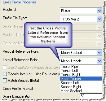
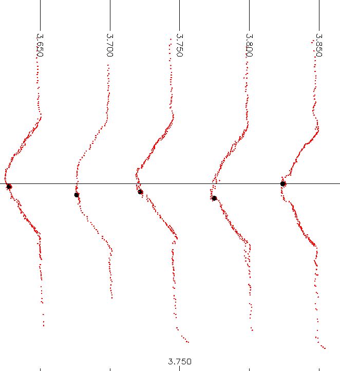
The Zero line on the Vertical Axis will then refer to the selected Lateral reference point.
E.g.
Note that for VisualWorks XP.csv format files, the Lateral position "Trench Left" refers to the PA Seabed marker, "Trench Right" refers to the SA Seabed marker and "Mean Trench" is calculated from the average of the PA and SA Flags' x-offset.